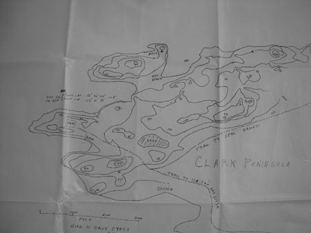
Map of Clark Peninsula by Seb Borrello and Dave Eyres
This is a topo map of Clark Island. It is on vellum paper. Dave Eyres and I mapped Clark in 1958 using a theodolite, level, table and pole. Dave sent the original to Washington or somewhere, but it got lost. Willis Tressler tried to find it back in the 60s. I think it was never found. I made the vellum copy as we mapped in light pencil, and I went over the pencil with ink several years ago. The original copy is now held at the Australian Antarctic Division.
Seb Borrello 2007


